Benjamin Donn – Putting Devon on the map
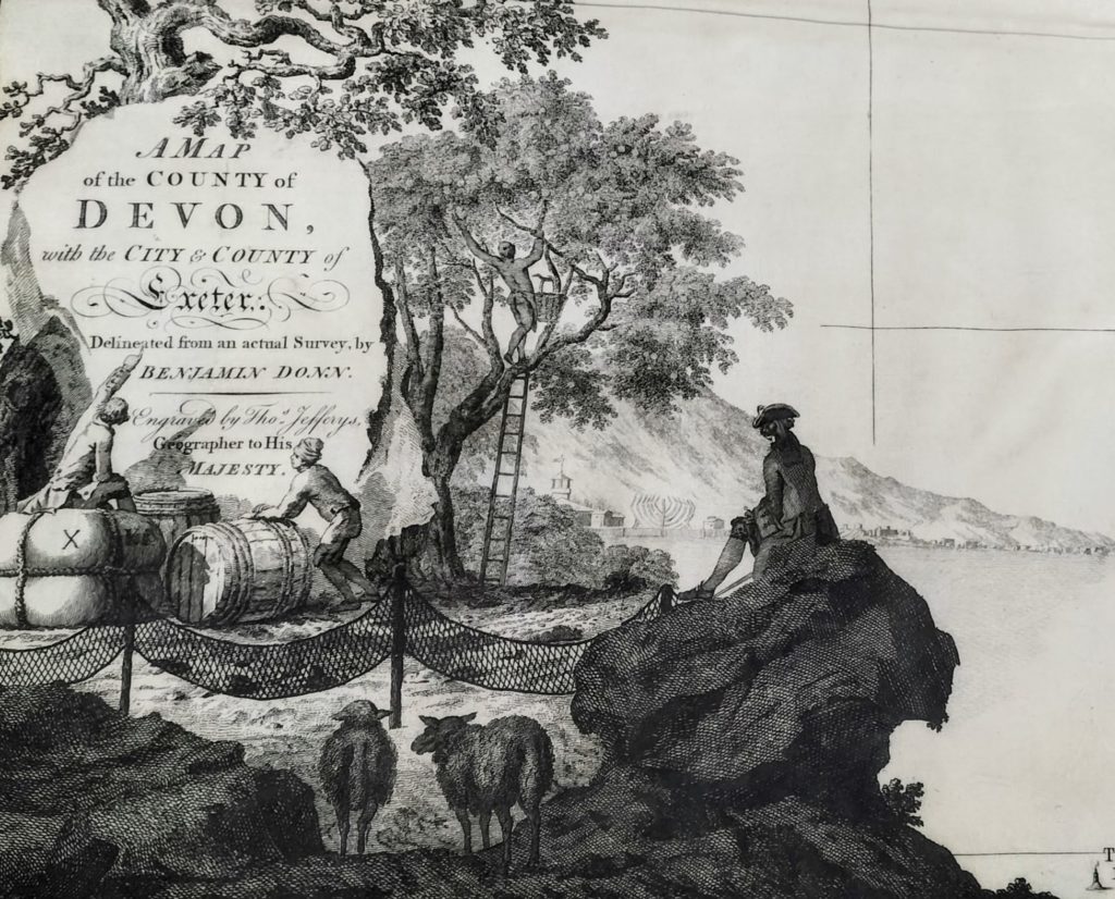
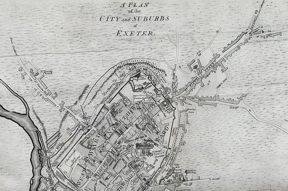
In a fine example of competition as the fuel for innovation and scientific advancement, Benjamin Donn[e] produced A map of the county of Devon, with the city and county of Exeter in 1765, after a prize for £100 was put forward by The Society for the Encouragement of Arts, Commerce and Manufactures for the best county survey. This was then published as a bound volume, of which the Devon and Exeter Institution holds a first edition, beautifully printed on vellum.
Donn was born in Bideford in 1729, where he followed in his father’s footsteps to become a mathematics teacher of some repute, with articles published in several scientific journals. Shortly after the publication of his survey of Devon, he relocated to Bristol and founded a mathematical academy, where ‘young men were boarded and taught’. The invitation was also extended to young ladies, who could learn ‘any branch of Mathematics and Natural Philosophy’. A number of pamphlets reveal his skill as a maker of instruments, including ‘Donn’s improved navigation scale’ and ‘Geo-Organon and Improved Analemma, or Substitutes for the Terrestrial and Celestial Globe’.
He set about his great project to map the county in around 1759, during a significant period of development in the field of surveying. Ordnance Survey trace their history back to the endeavours of a young engineer called William Roy, who was tasked with mapping the Scottish Highlands in 1747. Roy is said to have used compasses and 50 feet long chains to take his measurements, but the precise instruments that Donn had at his disposal, of his own invention or otherwise, are not described in his book.
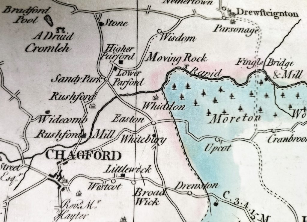
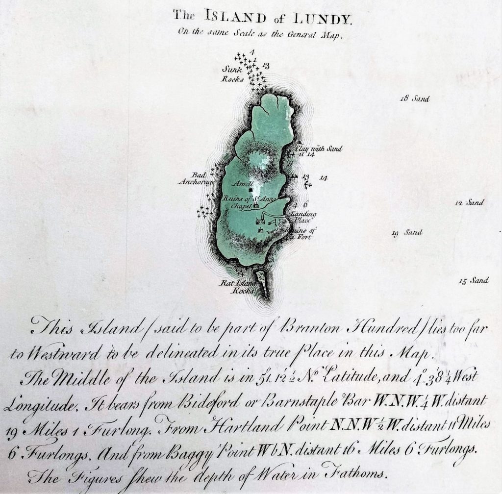
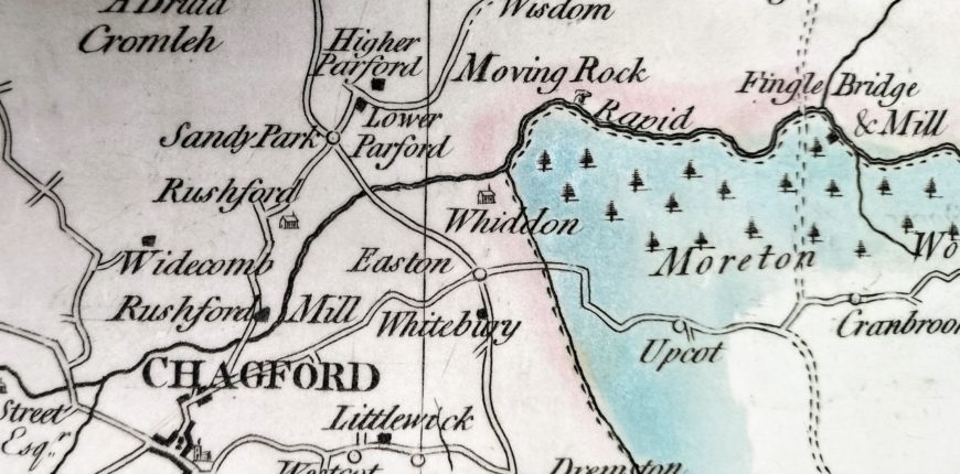
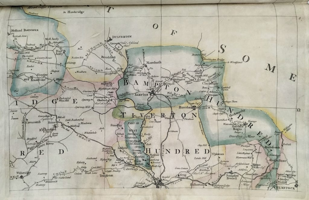
The engraving itself was undertaken by Thomas Jefferys, Geographer to His Majesty. Donn applied to The Society for the Encouragement of Arts, Commerce and Manufactures for an extension so that Jefferys was able to finish the plates; this was indeed a work of artistry, as well as cartography. Alongside towns, villages, roads and rivers, the map includes archaeological features, farms, cottages, mines and churches. Names of significant occupants are noted next to particular residences, and distances between towns and villages are marked in miles, furlongs and poles. There are even helpful tips for road use; those travelling from North Tawton are advised to ‘turn in at the bridge to avoid the river when the water is high’.
Donn claimed the £100 prize, although he estimated that the survey had cost him upwards of £1,900. After six years of careful calculations and hard graft, he had produced one of the earliest county maps, greatly improving on the existing knowledge of the geography of Devon.